Salt River Restoration
Location: Eel River Estuary, Humboldt County California
Client/Partners: Humboldt County Resource Conservation District, US Fish & Wildlife Service, and GHD, Inc.
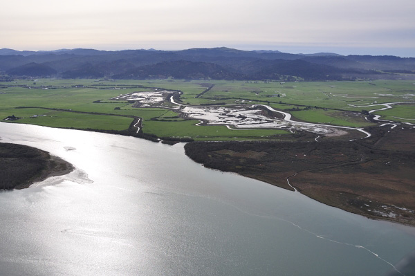

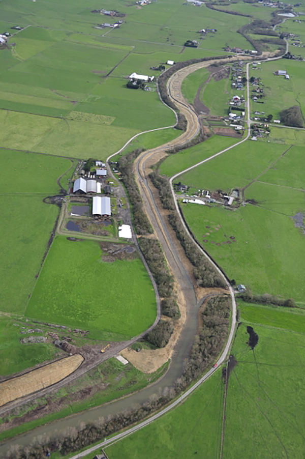


Michael Love & Associates (MLA) provided geomorphic and engineering services in developing the restoration plan for both tidal and fluvial dominated reaches of the Salt River. The Salt River was once used by ocean-going ships that entered the Eel River estuary from the Pacific Ocean. However, upslope mass wasting and land-use changes, including diking and draining tidelands and construction of a levee along the floodplain that eliminated scouring overbank flows from the Eel River, lead to over 20 feet of siltation in the Salt River, making it unable to provide drainage for the Eel River bottoms and Town of Ferndale.
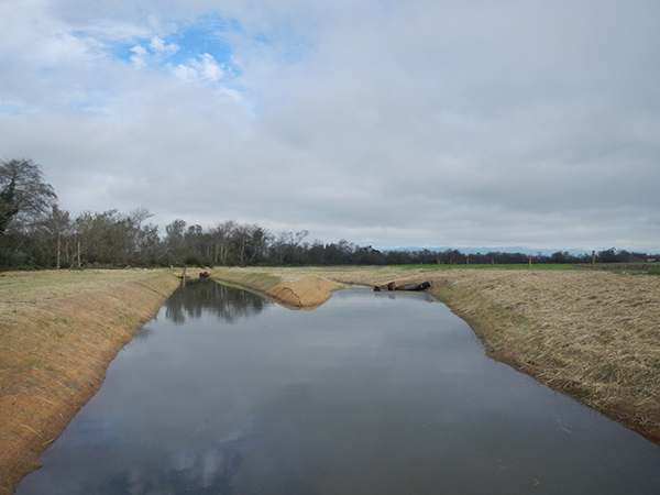
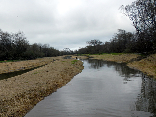
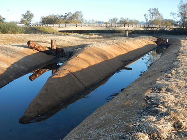
MLA, working with the USFWS, conducted geomorphic assessments and reference reach characterizations, and developed a stream channel design appropriate for transporting the high silt load through the 4 miles of restored river, while providing benches for long-term sediment aggradation. The channel design included an active channel sized for the “dominate discharge,” side channels and active benches for conveying higher flows and providing surfaces for sediment deposition, and a berm to confine the active channel and increase stream power to keep coarser sediment in transport. Bioengineering planting using live stakes and sedge plugs was also incorporated into the project to stabilized steeply graded slopes forming the banks of the constructed active channel. The lower section of the restored channel is at the fluvial-tidal interface, where sedimentation often occurs. To help keep sediment moving downriver, the lower channel included tidal benches to increase the tidal prism and thus provide tidal flushing.
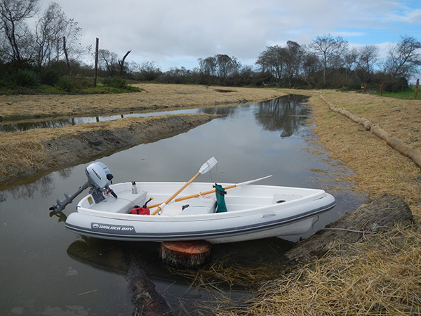
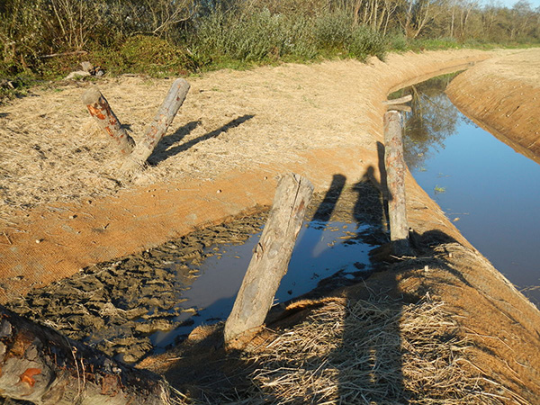
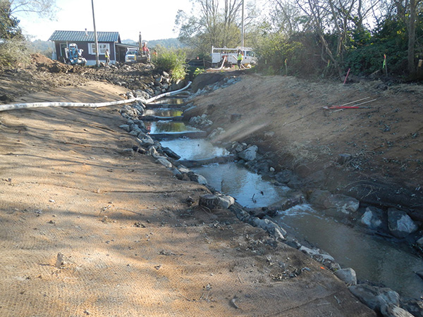
MLA staff led the design layout and surface grading for the channel alignment, sinuosity, and side-channel inlets and outlets. MLA designed large wood structures to support the geomorphic development of the channel and to provide fish passage. Wood structures included wood sills, log steps, rootwad deflectors, scour structures, and guide-logs. Wood structures were anchored using a combination of driven log piles and soil anchors. Construction of the first phase was completed in 2014 and has already improved drainage along adjacent roads and pastures. The second and third phases of the project are anticipated to be constructed in 2015 and 2016 respectively.